Satellite images show 40-mile-long Russian military convoy nearing Kyiv

admin

imageSatellite images show 40-mile-long Russian military convoy nearing Kyiv

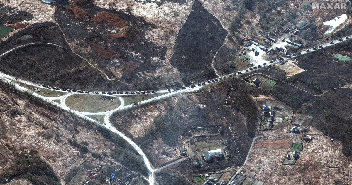
New satellite images show a large military convoy north of Kyiv, Ukraine extends for almost 40 miles.

It is considerably longer than 17 miles as initially reported this morning by Maxar Technologies.

Based on additional imagery collected, the Russian military convoy stretches from near Antonov airport in the south to the northern end of the convoy near Prybirsk.

Along parts of the route, some vehicles are spaced fairly far apart while in other sections military equipment and units are traveling two or three vehicles abreast on the road.

Copyright 2022 NPR.To see more, visit https://www.npr.org..

Leave a Reply

Your email address will not be published. Required fields are marked *

Next Post

Satellite images show 40-mile-long Russian military convoy north of Kyiv alongside burning buildings

New satellite images provided by Maxar Technologies show a 40-mile-long Russian military convoy.The convoy stretches from 17 miles north of Kyiv’s city center, to Pribyrsk, Ukraine.On Sunday, Maxar had measured that the convoy was 3.5 miles long.Get a daily selection of our top stories based on your reading preferences.New satellite […]

Subscribe US Now